


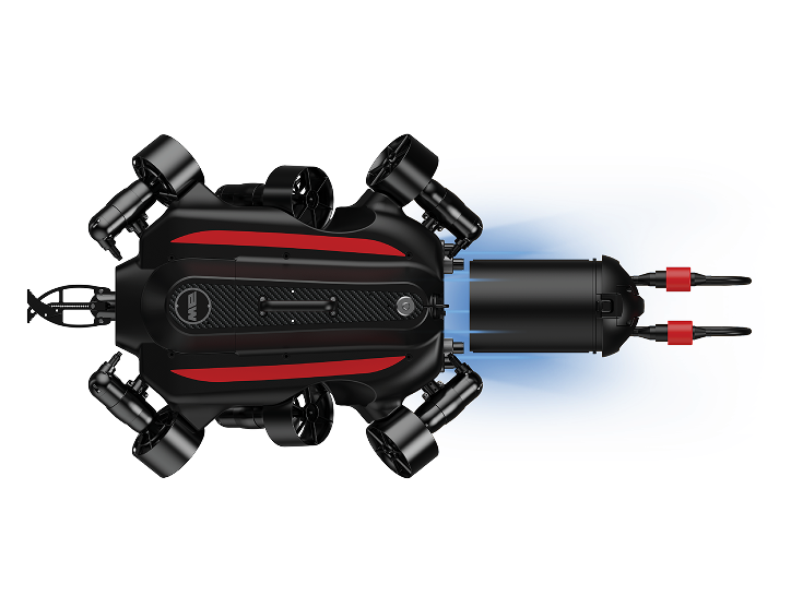
FIFISH W6 NAVI Maritime ROV
Purpose-built for open-sea environments, the QYSEA FIFISH W6 NAVI combines autonomous underwater navigation with precision station-lock hovering to deliver reliable performance in search and rescue, vessel inspection, and seafloor mapping missions down to 350 metres.
U-INS — Underwater Inertial Navigation System
W6 NAVI’s built-in U-INS fuses deep-learning algorithms with multi-sensor data to deliver precise real-time position, velocity, heading, and attitude. Operators can define subsea mission routes, trigger one-click home return, and record points of interest — with the ROV self-navigating the entire survey path autonomously.
One-click Home Return · POI Marking · Subsea Mission Planning · Real-time Surface Positioning
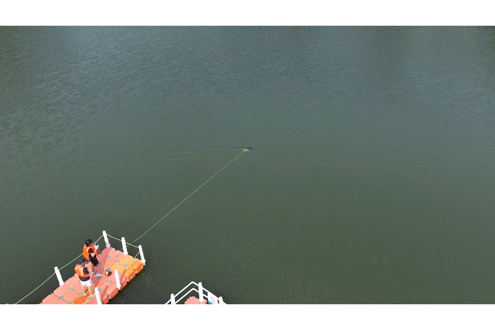
Q-DVL — Station Lock Hovering
The built-in Q-DVL locks the W6 NAVI’s position underwater and returns it precisely to that point even against currents, tether drag, and operational interference. Downward collision avoidance and real-time altitude tracking enable close-proximity inspection of hulls, piles, and seabed structures with full confidence.
Station Lock · Downward Collision Avoidance · Altitude Tracking

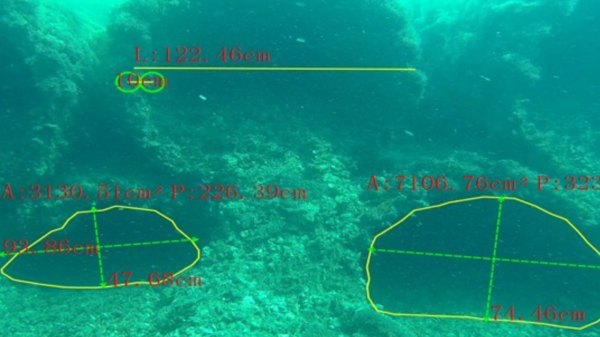
QY-MT — Smart Measurement Tool
W6 NAVI’s built-in laser scaler, paired with QYSEA’s QY-MT software, enables non-contact, millimetre-level measurements of underwater structures. Measure length, width, area, perimeter, and angles in real time — online or offline — and generate exportable inspection reports with annotated imagery for structural assessment and compliance documentation.
Applications: Hull crack sizing · Mooring line assessment · Bridge pile evaluation · Search & rescue dimensional analysis
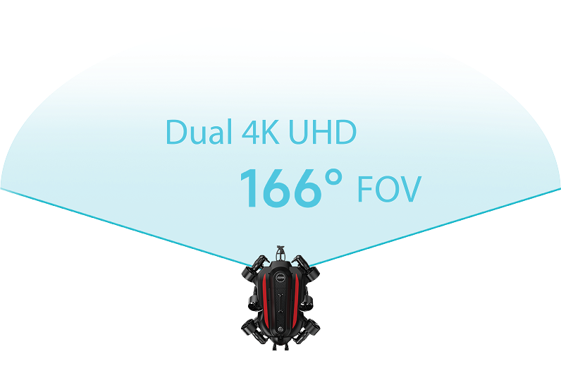
Dual 4K UHD Camera System
Two 12-megapixel 4K UHD cameras with an ultra-wide 166° horizontal field of view deliver a complete underwater picture in a single pass. Combined with 12,000-lumen dual LED lighting and FIFISH’s patented imaging software, the W6 NAVI captures exceptional detail in low-visibility, turbid, and deep-water conditions.
- Cameras: Dual 4K UHD / 12 MP each
- H-FOV: 166° | V-FOV: 100°
- Lighting: 12,000 Lm dual LED
- ISO: Up to 6,400
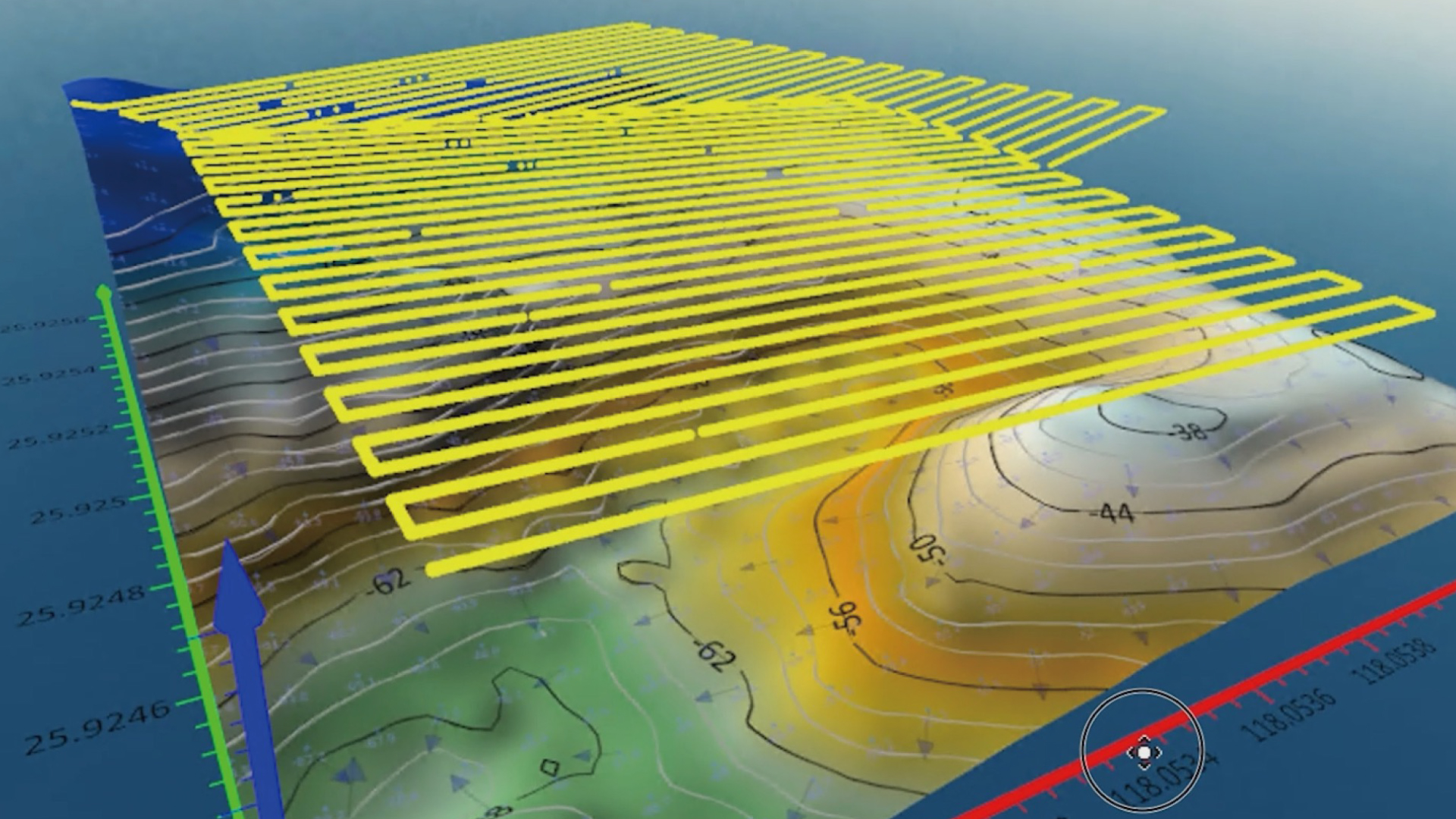
QY-BT — Bathymetric Mapping Tool
With the optional QY-BT software, the W6 NAVI becomes a full bathymetric survey platform. Plan systematic survey routes, acquire high-density depth data, and export detailed 2D and 3D seabed maps with real-time contour lines — all from a compact, rapidly deployable ROV.
Outputs: 2D depth maps · 3D seafloor topography · Real-time contour lines · Exportable survey data
388.8 Wh Hot-Swap Battery
The W6 NAVI’s 388.8 Wh removable battery is field-swappable without tools, keeping the ROV operational through back-to-back dives. Quick-charge mode reaches 70% in just one hour. An optional direct power supply system enables continuous 24/7 operations for long-duration inspection campaigns.
Capacity: 388.8 Wh | Quick Charge: 70% in 1 hour | Hot-swap: Tool-free field replacement
Industry Applications
Search & Rescue
Bridge & Infrastructure Inspection
Underwater Inspection
Deep Hovering & Mooring
Technical Specifications
| Max Depth | 350 m |
| Payload Capacity | 10 kg |
| Movement | 360° Omnidirectional |
| Navigation | U-INS (Underwater Inertial Navigation System, built-in) |
| Station Lock | Q-DVL (built-in) |
| Collision Avoidance | Downward (built-in) |
| Camera System | Dual 4K UHD, 12 MP each |
| Horizontal FOV | 166° |
| Vertical FOV | 100° |
| Max ISO | 6,400 |
| LED Lighting | 12,000 Lm (dual LED) |
| Battery | 388.8 Wh, removable / hot-swap |
| Quick Charge | 70% in 1 hour |
| Direct Power Supply | Optional |
| Bathymetric Tool | QY-BT (optional software add-on) |
| 2D Imaging Sonar | Optional integration |
| Brand | QYSEA |

